About
The Santa Cruz MPA Collaborative brings together marine protected area experts from local and federal agencies, nonprofits, ocean businesses, scientific institutions, and museums.
Resources
CDFW Central California MPA Guide
Oceanspaces Central Coast MPA Monitoring Page
The Otter Project’s MPA Watch Program
CMSF Central Coast Google MPA Tour
Save our Shores Blog: Into the Blue
Monterey Bay National Marine Sanctuary Exploration Center
SiMon: Sanctuary Integrated Monitoring Network
Monterey Bay Salmon and Trout Project Live Virtual Field Trips
Join the Collaborative
Upcoming Events
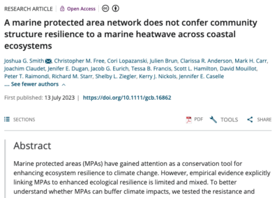
Related Publications

Projects

MPA Exhibit
The Santa Cruz MPA Collaborative worked with the Santa Cruz Children’s Museum of Discovery to integrate engaging, interactive, multi-media exhibits with understandable, user-friendly MPA educational content. The museum created an original interactive map of the local MPAs with content questions, which the visitor answers by pushing buttons that light up the correct answer.

MPA Mobile Cart
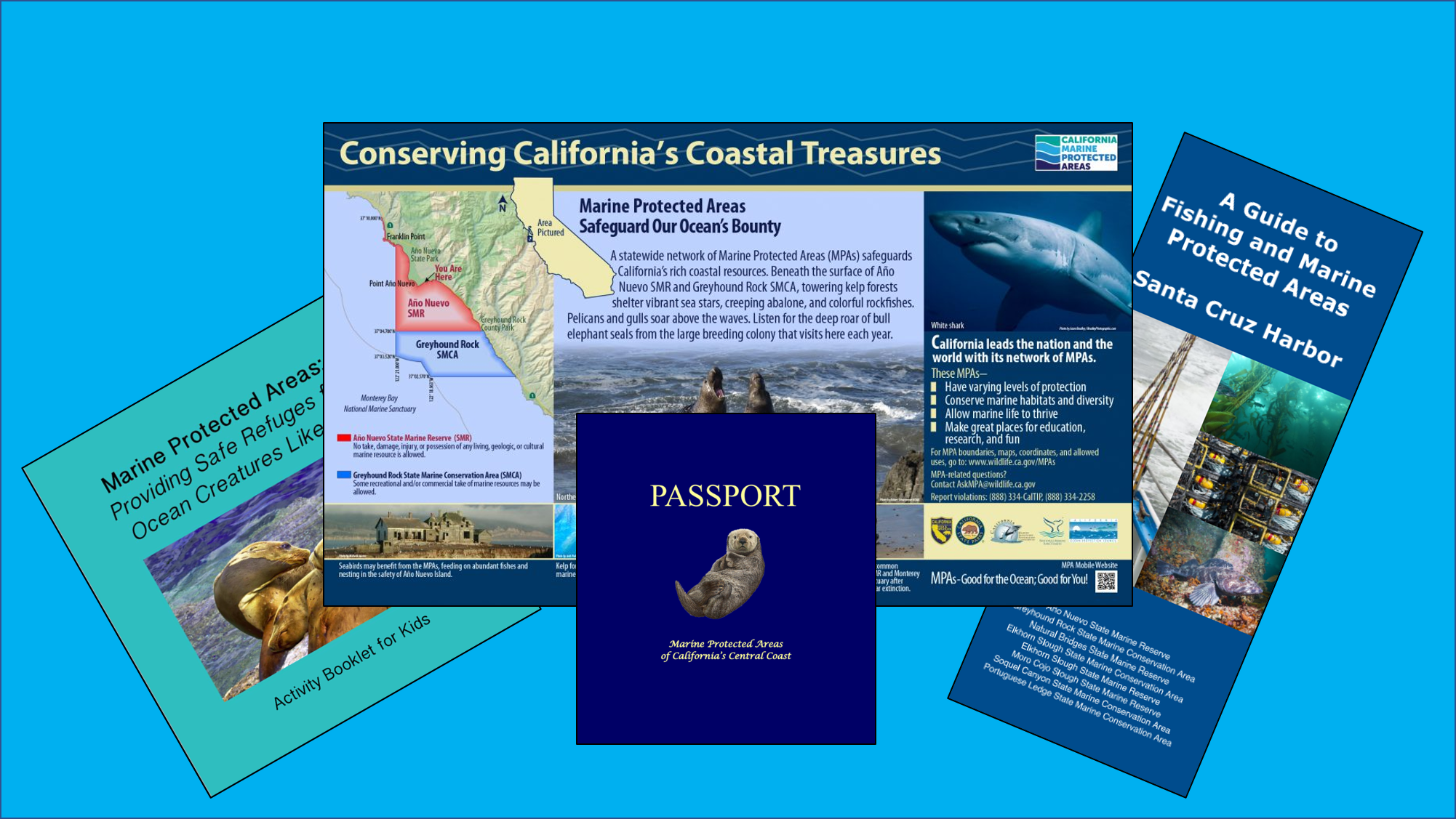
The Collaborative worked with Natural Bridges State Park on the development of a mobile cart that park docents use to facilitate MPA education. Components of the cart include brochures and pamphlets, educational MPA posters, curated skulls of adult and juvenile sea otters, a photo album of local tidepool inhabitants, interactive materials for children such as MPA Pledge postcards, beach treasure hunt, beach bingo, MPA activity booklet, as well as several items for children to touch and explore including a synthetic giant green anemone figure.
Docents and staff use the cart to speak with visitors about a myriad of topics and themes relating to Marine Protected Areas, including the importance of protecting the marine shoreline, local invertebrate diversity, beach safety, explaining how tides affect marine life, and increasing general awareness and understanding of MPAs.


General Rules for MPAs
For the most up to date information on general rules for MPAs, visit https://wildlife.ca.gov/Conservation/Marine/MPAs/Network/Central-California .
Access (CCR Title 14, Section 632 (a)(4))
Access into marine protected areas or marine managed areas for non-consumptive uses including but not limited to swimming, surfing, diving, boating, hiking and walking is allowed unless otherwise specified in individual MPA regulations.
Introduction of Species (CCR Title 14, Section 632 (a)(5))
Unless authorized by the commission or as a result of authorized fishing activities, the release of any fish or wildlife species, including domestic or domesticated species, or the introduction of any plant species, is prohibited. The department may reintroduce endemic species to marine protected areas or marine managed areas for management purposes.
Anchoring (CCR Title 14, Section 632 (a)(7))
Vessels shall be allowed to anchor in any marine protected area or marine managed area with catch onboard unless otherwise specified in individual MPA regulations. Fishing gear shall not be deployed in the water while anchored in a state marine reserve. Fishing gear, except legal fishing gear used to take species identified as allowed for take in individual MPA regulations, shall not be deployed in the water while anchored in a state marine recreational management area, state marine park or state marine conservation area. Anchoring regulations shall be consistent with federal law and allowances made for anchoring required by emergency or severe weather.
Transit or Drifting (CCR Title 14, Section 632 (a)(8))
Water Quality Monitoring (CCR Title 14, Section 632 (a)(9))
Sampling of water, sediment and marine life, for water quality monitoring or pollution research, or as required in a Monitoring and Reporting Program of a National Pollutant Discharge Elimination System (NPDES) Permit and Waste Discharge Requirements issued by the State or Regional Water Boards pursuant to the United States Clean Water Act and the California Water Code, is allowed within state marine reserves, state marine conservation areas, state marine parks, and state marine recreational management areas pursuant to a valid scientific collecting permit issued by the department.
Public Safety (CCR Title 14, Section 632 (a)(10))
Public safety activities, including installation, maintenance and/or seasonal placement and removal of safety-related artificial structures, including but not limited to lifeguard towers, are allowed within any MPA classification pursuant to any required federal, state and local permits, or as otherwise authorized by the department.
Tribal Take (CCR Title 14, Section 632 (a)(11))
“Federally recognized tribe” means any tribe on the List of Indian Entities Recognized and Eligible to Receive Services from the United States Bureau of Indian Affairs, published annually in the Federal Register. Any member of a federally recognized tribe authorized to take living marine resources from an area with area-specific take restrictions in individual MPA regulations, when engaging in take within an authorized area shall possess on his person, in his immediate possession, or where otherwise specifically required by law to be kept, any valid license, report card, tag, stamp, validation, permit, or any other entitlement that is required in the Fish and Game Code, or required by other state, federal, or local entities, in order to take living marine resources. Members shall possess a valid photo identification card issued by a federally recognized tribe that contains expiration date, tribal name, tribal member number, name, signature, date of birth, height, color of eyes, color of hair, weight, and sex; and display any of the items listed above upon demand to any peace officer. Members taking living marine resources under this provision are subject to current seasonal, bag, possession, gear and size limits in existing Fish and Game Code statutes and regulations of the Commission, except as otherwise provided for in individual MPA regulations. No member, while taking living marine resources, may be assisted by any person who does not possess a valid tribal identification card and is not properly licensed to take living marine resources. Nothing in the regulation is intended to conflict with, or supersede, any state or federal law regarding the take of protected, threatened or endangered species.
Shore Fishing (CCR Title 14, Section (a)(12))
Take from shore, or shore fishing, means take of living marine resources from shore, including beaches, banks, piers, jetties, breakwaters, docks, and other man-made structures connected to the shore. Unless specifically authorized in individual MPA regulations, no vessel, watercraft (motorized or non-motorized), or floating device may be used to assist in the take, transport or possession of species taken while shore fishing, except that a float tube or similar flotation device may be used when taking abalone only.
Santa Cruz MPAs
Año Nuevo State Marine Reserve
This reserve is divided by county lines and resides in both San Mateo and Santa Cruz County.
Boundary: This area is bounded by the mean high tide line and a distance of 200 feet seaward of mean lower low water between the following two points:
37° 10.000′ N. lat. 122° 21.800′ W. long.; and
37° 08.725′ N. lat. 122° 21.000′ W. long.
The area then continues southward bounded by the mean high tide line and straight lines connecting the following points in the order listed:
37° 08.725′ N. lat. 122° 21.000′ W. long.;
37° 04.700′ N. lat. 122° 21.000′ W. long.;
37° 04.700′ N. lat. 122° 16.062′ W. long.; and
37° 04.742′ N. lat. 122° 16.026′ W. long.
Permitted/Prohibited Uses: It is unlawful to injure, damage, take, or possess any living, geological, or cultural marine resource.
Greyhound Rock State Marine Reserve
Boundary: This area is bounded by the mean high tide line, the three nautical mile offshore boundary and straight lines connecting the following points in the order listed except where noted:
37° 04.742′ N. lat. 122° 16.026′ W. long.;
37° 04.700′ N. lat. 122° 16.062′ W. long.;
37° 04.700′ N. lat. 122° 21.000′ W. long.;
37° 03.520′ N. lat. 122° 21.000′ W. long.; thence southward along the three nautical mile offshore boundary to
37° 02.570′ N. lat. 122° 18.963′ W. long.; and
37° 02.570′ N. lat. 122° 13.989′ W. long.
Permitted/Prohibited Uses:
- It is unlawful to injure, damage, take, or possess any living, geological, or cultural marine resource for recreational and/or commercial purposes, with the following specified exceptions:
- The recreational take of giant kelp (Macrocystis pyrifera) by hand harvest only, market squid, salmon, and, by hook-and-line from shore only, other finfish is allowed.
- The commercial take of giant kelp (Macrocystis pyrifera) by hand harvest only, salmon, and market squid is allowed. Not more than five percent by weight of any commercial market squid catch landed or possessed shall be other incidentally taken species.
Natural Bridges State Marine Reserve
Boundary: This area is bounded by the mean high tide line and a distance of 200 feet seaward of mean lower low water between the following two points:
36° 57.912′ N. lat. 122° 07.650′ W. long.; and
36° 57.015′ N. lat. 122° 03.504′ W. long.
Permitted/Prohibited Uses: It is unlawful to injure, damage, take, or possess any living, geological, or cultural marine resource.

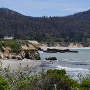
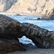
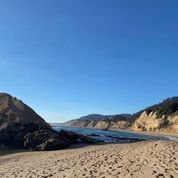
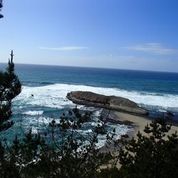
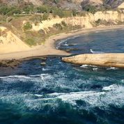
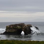
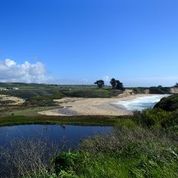
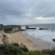
SCMPA Gallery


Santa Cruz MPA Collaborative Leadership Team
Lisa Uttal
Santa Cruz MPA Collaborative Co-Chair
Education and Outreach Specialist, Monterey Bay National Marine Sanctuary
lisa.uttal@noaa.gov
Nicole Crane
Santa Cruz MPA Collaborative Co-Chair
Krista Rogers
Santa Cruz MPA Collaborative Co-Chair
Education and Outreach Coordinator, Save Our Shores
krista@saveourshores.org
Santa Cruz MPA Collaborative Members
Do you see information or links that need to be updated? Let us know.
This list is not meant to imply that each affiliated organization is participating in the collaborative at a formal level nor that each collaborative member is representing the official view of their affiliation. All voices and perspectives are welcome and are considered unique to the person sharing them.
Bureau of Land Management – California Coastal Monument Bay Side Marine
Blue Mind
Cabrillo College
California Collaborative Fisheries Research Program
California Dept. of Fish and Wildlife
California Marine Sanctuary Foundation
California Regional Environmental Education Community
California State Parks
California State Parks Lifeguards
CSU Monterey Bay
City of Santa Cruz
Collaborative Fisheries Research West
Ecoshift Consulting
Elkhorn Slough Foundation
Elkhorn Slough National Estuarine Research ReserveHealthy Oceans Healthy People
Kayak Connection
Hopkins Marine Station
Monterey Bay Aquarium Research Institute
Monterey Bay Aquarium
Monterey Bay National Marine Sanctuary
Moss Landing Marine Laboratories
Pacific Grove Museum of National History
Point Lobos Foundation
Reef Check
The Otter Project